Home / Scripts & Code / CSS
USA Interactive Map With Pictures USA Interactive Map With Pictures
The map consists of HTML, CSS files. You can customize the map Pictures, links, hover information etc through simple html and cssHome / Scripts & Code / CSS
USA Interactive Map With Pictures
The map consists of HTML, CSS files. You can customize the map Pictures, links, hover information...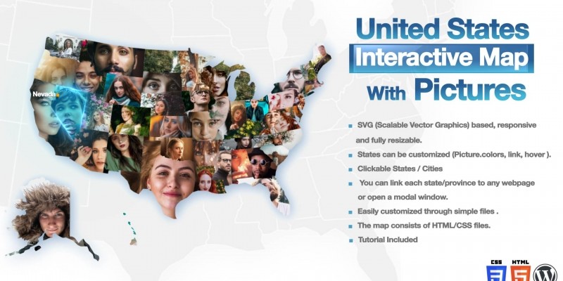
Screenshots


Overview
. SVG (Scalable Vector Graphics) based, responsive
and fully resizable.
. Tutorial Included
. States can be customized (Picture. colors, link, hover ).
. Clickable States / Cities
. You can link each state/province to any webpage
or open a modal window.
. Easily customized through simple files.
. The map consists of HTML/CSS files.
Requirements
Beginner level HTML - CSS (JavaScript is not required)
Other items by this author
Information
| Category | Scripts & Code / CSS |
| First release | 6 February 2021 |
| Last update | 6 February 2021 |
| Files included | .css, .html |
| Tags | Javascript, interactive, map, svg, google maps, Map plugin, clickable, us map, interactive maps, mapping tool, states map, united states map, us cities map, us map a website |